CUGIR WFS from QGIS
Web Services WFS QGISAccessing CUGIR WFS (Web Feature Services) using QGIS
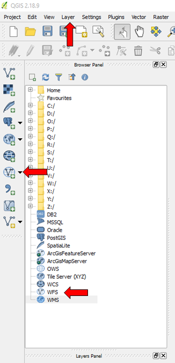
QGIS is a free and open source Geospatial Information System offering a number of enhanced capabilities, such as the ability to import and display various web services, including WFS layers. You can add a CUGIR WFS layer to a map in QGIS a number of ways, highlighted by the red arrows to the left. After clicking the appropriate WFS icon (right click the smaller one in the Browser Panel) or selecting Layer>Add Layer>Add WFS, name and enter the CUGIR WFS services URL (http://cugir.library.cornell.edu/geoserver/cugir/wfs) in the Create a new WFS connection dialogue box.
NOTE: Though each data description page provides a Web Services link within its respective Tools menu, the URL for accessing those is the same for all CUGIR WFS layers. After creating a new connection in QGIS you will need to select the layer you wish to import/display on your map from the Browser Panel.