CUGIR WMS from ArcGIS
Web Services WMS ArcGISAccessing CUGIR WMS (Web Map Services) using ArcGIS Desktop
ArcGIS Desktop can import and display various web services such as WMS layers.
The first time you access a CUGIR WMS layer, you will need to add the CUGIR WMS service to ArcMap’s list of GIS Servers. You only need to do this once – the next time you go to add a WMS layer to a map, you can simply select the CUGIR WMS server.
In the “Add Data” dialog, go up to the top level of the browse hierarchy, then double-click “GIS Servers”,
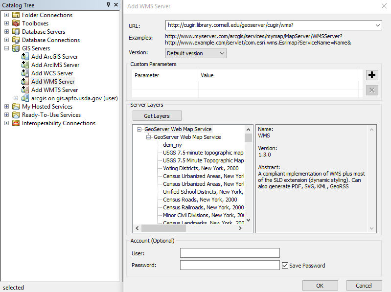
then double-click “Add WMS Server” and enter the CUGIR WMS server URL: https://cugir.library.cornell.edu/geoserver/cugir/wms
You can click “Get Layers” to check the URL. If successful, it will display all the WMS layers available from CUGIR.
Click OK to close the dialog, and you should see “CUGIR WMS on cugir.library.cornell.edu” listed as a data source.
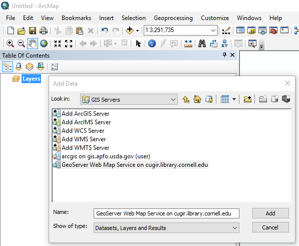
To add a specific CUGIR WMS layer, double-click “CUGIR WMS on cugir.library.cornell.edu”, then double-click “CUGIR WMS” until you see a list of individual layers. Select the layer you would like to add to your map, then click “Add”.
NOTE: Not all CUGIR datasets are available via WMS. CUGIR does not offer WMS for datasets in .e00 format, or for those that are hosted remotely.