CUGIR WMS from QGIS
Web Services WMS QGISAccessing CUGIR WMS (Web Map Services) using QGIS
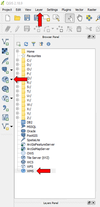 QGIS is a free and open source Geospatial Information System offering a number of enhanced capabilities, such as the ability to import and display various web services, including WMS layers. You can add a CUGIR WMS layer to a map in QGIS a number of ways, highlighted by the red arrows to the left (using QGIS 2.18.9 Desktop application). After clicking the appropriate WMS icon (right click the smaller one in the Browser Panel) or selecting Layer>Add Layer>Add WMS, name and enter the following URL in the Create a new WMS connection dialogue box:
http://cugir.library.cornell.edu/geoserver/cugir/wms
NOTE: Though each data description page provides a Web Services link within its respective Tools menu, the URL for accessing those is the same for all CUGIR WMS layers. After creating a new connection in QGIS you will need to select the layer you wish to import/display on your map from the Browser Panel.